Working with 3D Models
Learn how to add and work with 3D models.
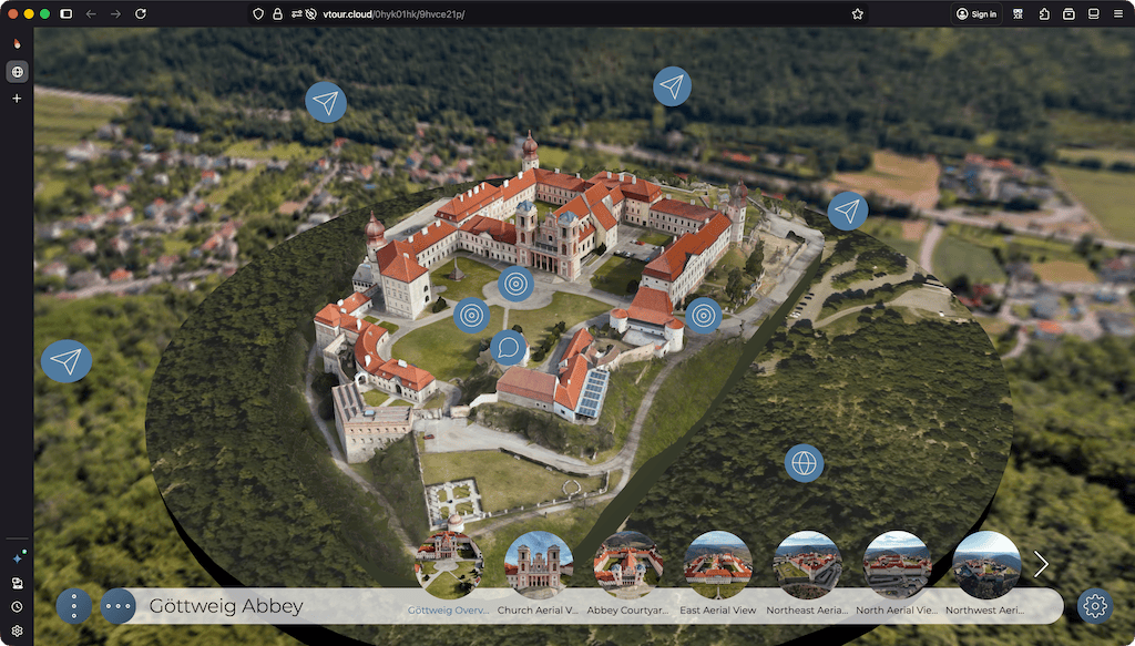
3D models can be integrated into virtual tours to provide context, orientation, and visual detail. They are commonly used to show floor plans, dollhouse views, cutaway models, or to show the details of any three-dimensional object.
In this section, you’ll learn how to add a 3D model to a tour, use it for smooth transitions between nodes, and make its objects react to visitors.
If you’re new to creating 3D models and Gaussian splats, there are many resources online that teach you how to create them. A good way to get started is your smartphone and an app like Polycam or RealityScan, which use the phone’s lidar sensor or camera to create a model.
Supported Formats
Pano2VR supports the following 3D file formats:
3D Mesh
- GLB
- glTF
Gaussian Splats
- PLY
- SPLAT and KSPLAT
- SPZ
- SOG
- RAD (optimized splats with levels of detail, see Optimize)
3D Tiles
- A 3D Tiles tile set, added through its
.jsonfile
Exporting from Mobile Apps
| App Name | To get a Standard Model (Mesh) | To get a Gaussian Splat |
|---|---|---|
| Polycam | Choose GLTF. (Note: This creates a .glb file. This is correct.) |
Choose Splat. (Use the .ply or .splat file) |
| RealityScan | Export as .glb. (If prompted, export via Sketchfab) |
Not supported. |
| Luma AI | Choose Export > Mesh > GLB. (Best for game engines/Blender) |
Choose Export > Splat. (Best for photorealism) |
| Scaniverse | Choose GLB. (Standard mesh) |
Choose SPZ. (Best for speed/quality balance) |
Start with Basic Tutorials
-
Add a 3D model to a tour: Learn how to add a 3D model as a starting point or reference in a virtual tour.
-
Use a 3D model for transitions: See how to use a 3D model to create smooth transitions between tour nodes.
-
Create an interactive 3D object: Make the objects of a model react to clicks, for example to play one of its animations.
-
Moving and adjusting 3D Models: Learn how to move and adjust 3D models in Pano2VR.
-
Place a model on the map: Once the model is linked to your tour nodes, derive its GPS position from the nodes, or the nodes’ positions from the model.
Helpful Tools
- Model Converter: OBJ to GLB with WebP or KTX2 textures.
- glTF Editor
- Gaussian Splat Editor and Converter: Supersplat